

Mapping (GIS) - LGM Resources
These resource tools have been designed for Operational First Nations. The LGM is a guide to land governance and provides extensive documentation, process support, guidance and is regularly updated and refined based on First Nation successes, challenges and needs. Some of these tools have been prepared by the Resource Centre for knowledge sharing purposes only. Please contact the GIS Specialist for more information.
LGM Mapping (GIS) Chapter
Glossary of Terms - GIS & Mapping
GIS FAQs
GIS Needs Assessment
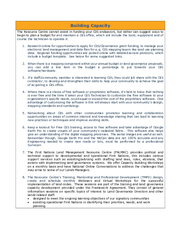
LGM - Capacity Building
GIS Layers Resource List - A Quick Reference Guide
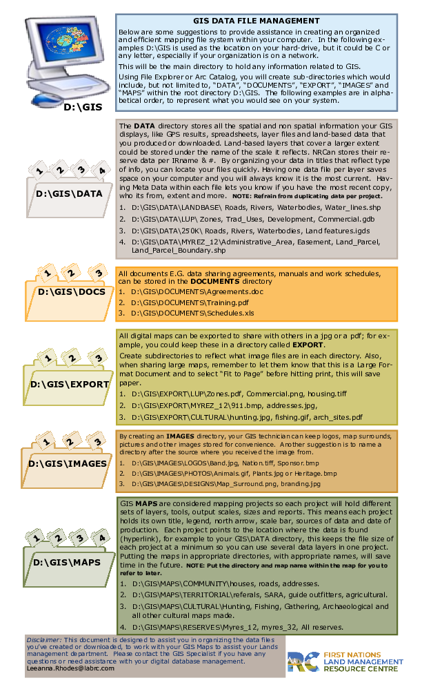
GIS File Management
GIS Good Practices Guide-CIER
Canada Lands in Google Earth
Last Modified: août 21, 2022